
Follow a Sedalia Street
A street-by-street search works best as a handoff, not as a claim that one list names every household. Begin with a known street number in the Pettis parcel system. Keep its account number, owner of record, physical address, mailing address, and legal description together. The account and legal description are better bridge fields than a casual version of the street name. From there, each source answers one part of the question: the parcel record identifies land, the Recorder identifies a recorded transfer, election records may confirm limited registration information, and a historical directory may place a named person at an address in a particular year.
For a Sedalia street directory search, record the exact search date and do not turn a parcel result into an occupancy claim. A person can own a home and receive tax mail elsewhere. A historical directory entry can refer to a boarder, a business user, or a relative. The chain is still useful because it gives each next source a checkable key.
- Search the physical house number, street name, and city in the county property form. Save the parcel account and legal description with the displayed owner data.
- Use the owner as a grantee in the Recorder index, then capture the seller, recording date, document number or book/page, and legal description from the latest conveyance.
- Compare the parcel with an official map only for geographic context. City map layers can place the address in a ward, precinct, district, or project area, but they do not establish ownership.
- For a voter question, use the state confirmation form with its required identifiers or make a narrow request to the Pettis County Clerk. Treat the result as registration evidence only.
- For an earlier household, ask Sedalia Public Library about a reverse or criss-cross directory for the needed year, then compare that entry with deeds, census material, and newspaper notices.
Sedalia Street Directory Parcel Search
Pettis County Devnet is the strongest documented starting point for a current address. Its real-estate form separates physical House Number, Street Name, and City from owner and mailing-address fields. It can also narrow results with account number, owner name, mailing city, state and ZIP, sale price and date ranges, townships, property classes, and land uses. The personal-property form is separate. That distinction matters when a Sedalia street directory question concerns land rather than an account that is not real estate.
| Devnet field group | Use in an address search | Observed format or limit |
|---|---|---|
| Account Number; Owner Name | Return to a known parcel or owner of record | Optional text fields |
| House Number; Street Name; City | Start with a physical Sedalia address | Optional text fields |
| Mailing address, city, state, ZIP | Find the tax-mailing contact separately | State is a dropdown; ZIP is text |
| Sale price and sale date | Narrow a transfer period or value range | Optional minimum and maximum fields |
| Townships, Property Classes, Land Uses | Limit a broader street or parcel set | Optional dropdowns; option lists were not captured |
The county Devnet search form shows the address and ownership filters used for a Sedalia street directory search.
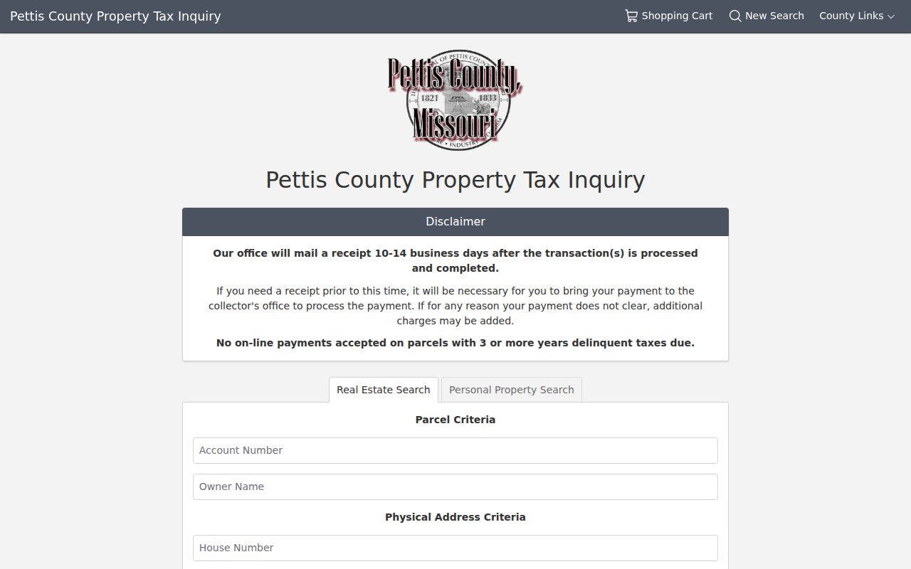
The form is evidence of available search fields, not proof of a particular parcel result. Live result cards, exports, and pagination were not captured, so save what the portal returns and verify any material detail with the county office.
Sedalia Addresses: Situs or Mailing
Two addresses on a Pettis parcel record can mean different things. The situs address is the physical parcel on the ground. The mailing address is where an owner or account receives the tax notice. A Sedalia address search should carry both forward, but neither should be stretched beyond its purpose. A mailing line can be outside the city, and a current owner can be an entity, trust, or person who does not live at the parcel. An exemption or homestead flag may be a clue, yet it is not conclusive evidence of occupancy.
Use the legal description when a street search stops working. Old deeds may identify a lot, block, named subdivision, or metes-and-bounds description instead of the present street number. Plats and surveys help join that description to street geometry. The Pettis Recorder advertises plats and surveys reaching back to 1833, while the county map viewer is a separate route for geography.
- Parcel
- A unit of land tracked by the county for assessment and tax purposes, usually tied to an account number.
- Situs address
- The physical address of the parcel, not necessarily the owner's postal address.
- Plat
- A recorded map that lays out lots, blocks, streets, or subdivisions and can connect a legal description to a location.
- Criss-cross directory
- A reverse directory arranged by street or address rather than alphabetically by name.
Sedalia Street Directory Deed Trails
The Pettis County Recorder of Deeds divides land research into a current Fidlar index and a historical Cott service. For a street segment, use each parcel's owner and legal description as the handoff to the deed chain. Search an owner as grantee to find an acquisition deed. The seller on that instrument is the grantor. Search that seller as a grantee to find the prior purchase, and repeat while recording document type, date, book/page or document number, and the same legal description.
Fidlar Tapestry is the recorder-linked land index for 1983 to the present. Its documented generic search fields include first and last name, document number and type, recording-date range, subdivision, lot, block, parcel, and map or bounds. Images and expanded services can require an account or payment, so the index should be treated as a route to the instrument, not a substitute for a certified copy when one is required.
The Fidlar land-record search is the current online layer of the Sedalia street directory deed trail.
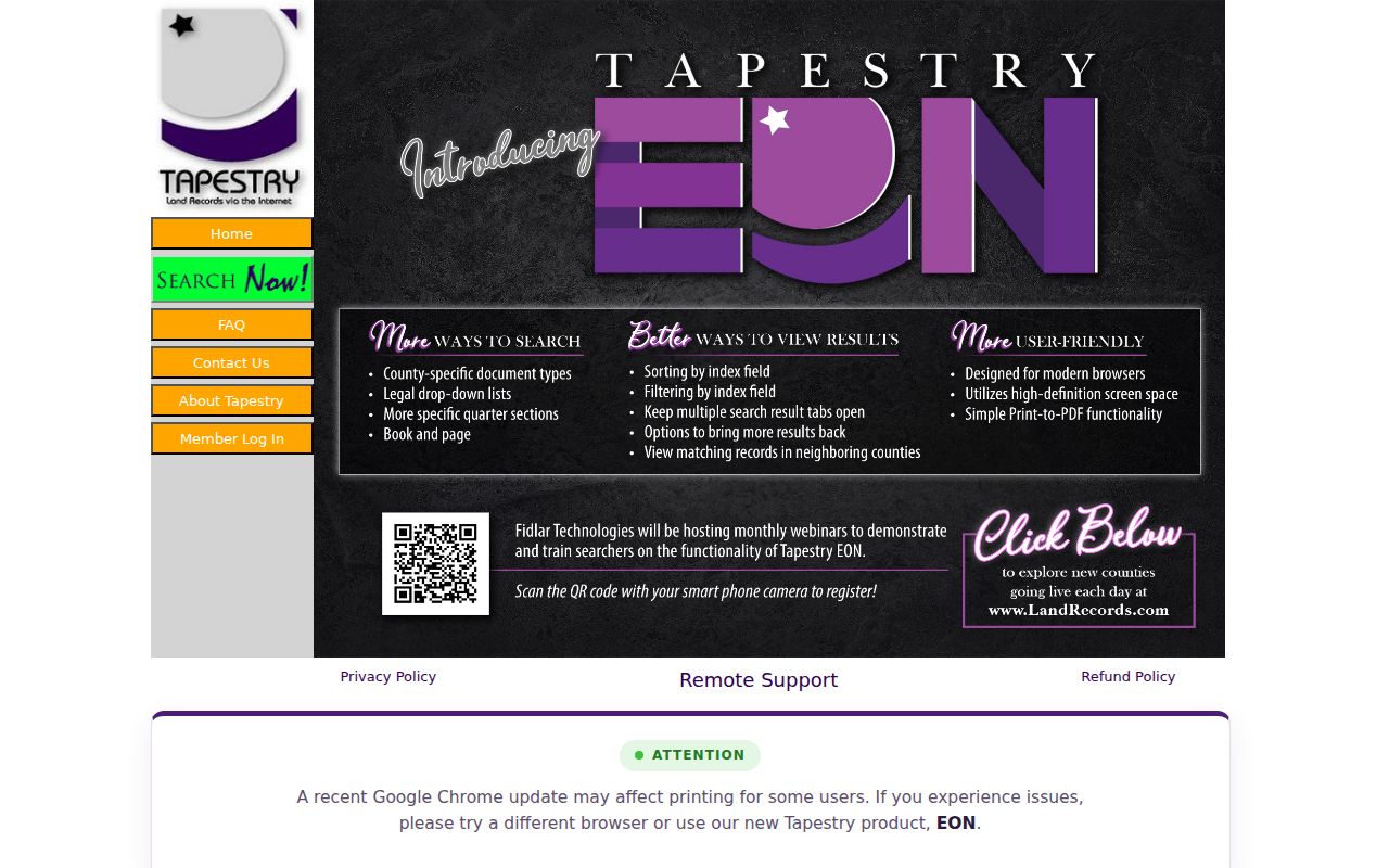
A street number may be absent from an old instrument. Preserve the lot, block, subdivision, or metes-and-bounds wording before moving to a prior grantor or another Recorder channel.
RecordHub for Older Sedalia Streets
The overlap between current and historical land indexes is especially useful for an old Sedalia street directory search. RecordHub offers free index and book research from 1833 through 1994, while Fidlar begins in 1983. Search the same party name or legal description in both systems when the transfer falls in the overlap. That can reveal a book/page reference or spelling variant that gives the next link in a chain. When the image is unavailable or a certified instrument is needed, use the Recorder's counter or formal copy route.
Cott's documented Simple Search and Expanded Search tools support exact matching, quoted phrases, a trailing asterisk after at least two characters, book/page, date ranges, and document categories. Expanded Search requires a last name, begins with matching by default, can use contains, and has a Name Directory showing unique spellings and counts. Results may list scan pages, date, type, Party One, Party Two, description, file number, and book/page. These are useful finding details, not confirmation that every result image is openly available.
The Cott RecordHub index supplies the older book and name-search layer for the Sedalia street directory.
Use a surname variant from the Name Directory before deciding a person is absent. Then keep the book/page, date, and legal description with the parcel notes for an audit trail.
Sedalia Street Maps With Limits
Pettis County GIS links to the official Beacon viewer, but Beacon returned a 402 response during the research run. Its live layers, parcel-card fields, browse controls, and adjacent-parcel tools were therefore not verified. Do not assume the viewer has a radius search, a full street browse, or an owner layer. If it opens, use it to orient a parcel and confirm what the current interface actually displays.
Sedalia also maintains city ArcGIS mapping resources. The documented city context includes zoning, wards and precincts, TIF, downtown, parking, and project-related maps. Those layers can explain the setting of an address, but they are not ownership evidence. A written GIS request is the fallback when a map card or underlying data cannot be reached online.
Sedalia Street Directory Voter Boundaries
Missouri's voter lookup is a confirmation form, not a browseable Sedalia street directory. The Secretary of State form asks for first and last name, date of birth, last four Social Security digits, and county. Public voter fields under RSMo 115.157 are defined by statute and include name, year of birth, address, township or ward, precinct, districts, party affiliation, and voter history, subject to protected-address exceptions. Full date of birth, Social Security data, and ballot choices are not public directory fields.
RSMo 115.163 permits precinct registers arranged alphabetically or by street address to be inspected at reasonable times, with exceptions. The local route is the Pettis County Clerk. No standalone county voter-file form was documented, so a written Sunshine request should identify a narrow election or precinct scope, the fields needed, the preferred format, and a lawful noncommercial purpose. The Clerk may apply redactions or quote a fee. A registration match never establishes the other people in a household.
Note: Keep voter results to the statutory purpose and minimum necessary fields, especially when a search involves a protected address or a person with a common name.
Sedalia Address Files by Record
Different public records point to different events along a Sedalia street. The table keeps the access route separate from the conclusion. No single row becomes a current household list. Use an account or legal description to connect parcel and deed material, then use a dated directory or permitted election record only for the narrower question it can answer.
| Address-keyed source | Custodian or route | What it can show | Access caveat |
|---|---|---|---|
| Property and tax roll | Pettis Assessor/Collector through Devnet | Owner, account, situs and mailing address, sale, class, and land-use context | Live result fields and export behavior were not captured |
| Recorder deed indexes | Pettis Recorder, Fidlar, and RecordHub | Grantor/grantee, transfer placement, document and legal-description clues | Image and copy conditions vary |
| Plats and surveys | Pettis Recorder and GIS routes | Lot, block, subdivision, and survey geometry | Copies may require a request |
| City permits and code files | Sedalia Code Enforcement or records intake | Construction, demolition, inspection, or complaint context by address | No public permit-history index was located |
| Historical reverse directories | Sedalia Public Library | Address-linked historical occupant or business clues | Confirm year, format, and abbreviations |
Sedalia Code Enforcement handles building, zoning, floodplain, nuisance, and inspection duties. Ask for an address and date range, then request only the public file details needed, such as permit number, issue or close date, scope, and inspection result. The city has forms and records-request routes, but no online history search was found.
Sedalia Street Directory History Clues
For older people on a Sedalia street, a reverse or criss-cross directory adds the address-to-name layer missing from a deed. Sedalia Public Library's genealogy resources include directories, newspaper microfilm, yearbooks, obituaries, cemetery records, and research requests. The library reports city directories beginning in 1867 and Sedalia Democrat microfilm beginning in December 1871. Ask staff whether the needed volume is alphabetic, reverse, criss-cross, telephone, or business-only before drawing a conclusion from a missing name.
Directory entries are dated snapshots. Compare adjacent available years, then test the address against a deed, census schedule, newspaper notice, cemetery record, or probate file. The historical collections are described in more depth in the Sedalia Directory Book. The useful street result is a documented match in a named source and year, not a claim that every person at an address has been found.
Sedalia Street Directory Limits
A street directory cannot reveal every person who lives at an address. Parcel records identify an owner of record, not everyone who uses the property. Voter information has statutory limits and protected-address exceptions. Utility customer lists and motor-vehicle address data are not an open street source. Safe at Home participants and other protected people may use substitute or withheld addresses, so an empty result must never be treated as proof that a person was never present.
Use this Sedalia street directory for family history, property history, civic questions, and careful verification. Keep original source names, access dates, book/pages, and request references. When a source is unclear, contact the office that holds it rather than filling the gap with inference.
Lawful use. Sedalia address records support careful personal and historical research. Do not use a record to stalk, harass, intimidate, or otherwise harm anyone; Missouri law restricts that conduct.