
Sedalia Neighbors Block Sources
Public records around a Sedalia address identify land and public civic context in different ways. Parcel material can identify a property and its owner of record. Deeds and plats can connect that parcel to a legal description. A map layer can provide boundaries and project context. None of those sources produces a complete list of everyone on a block. Keep each conclusion tied to the source that supports it and distinguish the property owner from other people who may be associated with an address.
| Source | What It Reveals on a Block | Access |
|---|---|---|
| Devnet parcel search | Account, owner of record, situs and mailing fields, property context | Search every adjacent parcel individually |
| County Beacon GIS | Parcel geometry and adjacent geography, when the viewer loads | Official link; live controls were not captured |
| City ArcGIS maps | Zoning, wards, precincts, TIF, downtown, parking, and project context | Public interactive applications |
| Recorder deeds and plats | Lot, block, subdivision, legal identity, and transfer chain | Fidlar, Cott/RecordHub, counter, copies |
| Voter register and civic sources | Defined public fields, lawful precinct context, public organizations | Lookup, Clerk request, public pages |
Use a short working sheet for the target parcel and each parcel touching or facing it: street address, account or parcel number, owner of record, mailing city/state/ZIP, legal description, date checked, and source. The structure reduces accidental mix-ups where an address, a tax mailing line, and a nearby lot all look similar.
Note: Keep a separate row for every parcel even when two adjacent records share a similar mailing line.
Map Sedalia Neighbor Parcels
The adjacent-parcel method starts with a known address and expands only to the parcels physically touching it or facing the same block. The official Pettis County link points to Beacon, but its viewer returned an access barrier during research. No automatic radius, neighbor list, export, select, or buffer feature was captured. Use the city map as geographic context and make a hand-built list of parcels rather than promising a tool result that has not been verified.
- Open the official map route and locate the target address if the map provides it. Write down the parcel, account number, or legal description shown.
- Inspect each touching or facing parcel one at a time. Keep a separate row for each parcel, even when two addresses share a name or mailing line.
- Search the parcel in Devnet and compare the owner of record, situs field, mailing field, and date checked.
- Use the Recorder’s grantor/grantee index and a plat when the map label is unclear or the legal description needs confirmation.
- Stop at the immediate block. For a full named-street chain, use the Sedalia street directory workflow instead.
A legal description is the stronger handoff key when the street line fails. It may use a lot, block, subdivision, book, or page reference. A plat or survey ties that description to land geometry, while a deed establishes the recorded transfer history.
Compare Sedalia Neighbor Ownership
The Pettis Devnet real-estate search accepts account number, owner name, house number, street name, city, mailing address, sale price or date, township, property class, and land-use filters. It keeps physical and mailing fields separate. That matters because a tax notice can go to a different location than the parcel. An account can show an ownership relationship without answering who is present at the address on a given day.
View the Pettis real-estate search fields before choosing the narrowest available query.
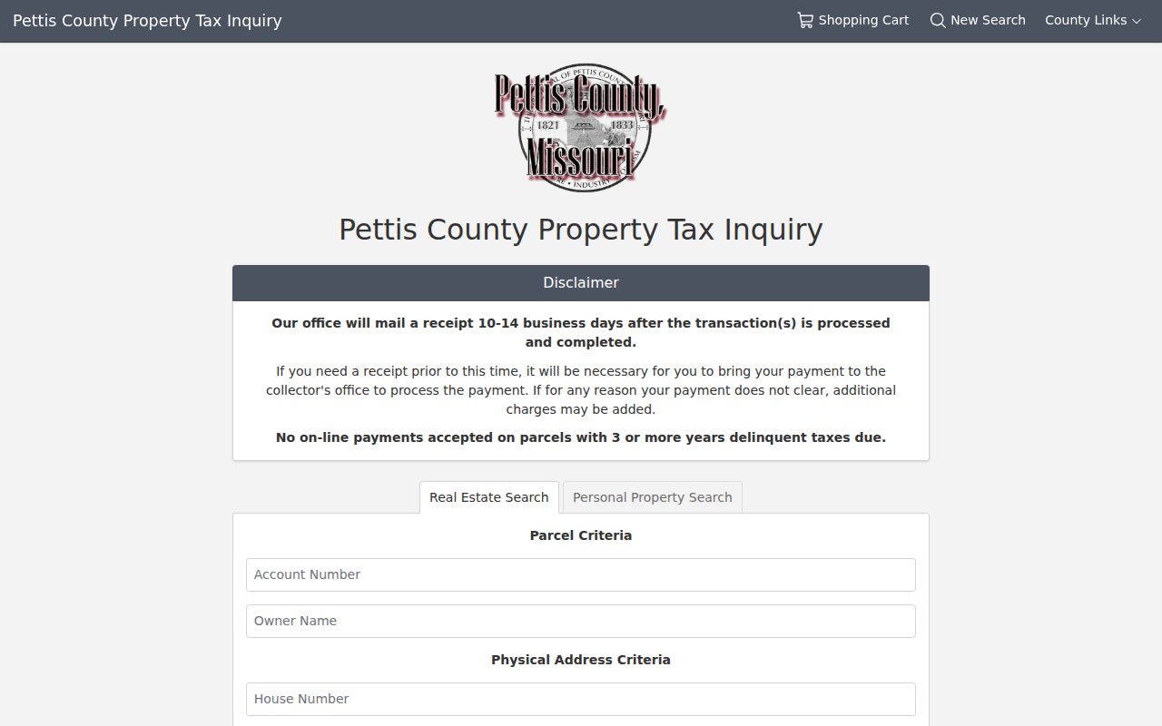
The form separates real-estate and personal-property searches and provides a useful starting point for one parcel at a time.
Compare the Devnet result with the Pettis County Recorder index. Fidlar covers the current land index from 1983 forward, while the Recorder-linked Cott historical books and index reach 1833 through 1994. The grantor, grantee, recorded date, and legal description provide a traceable way to test whether two parcel records belong in the same chain.
Sedalia Neighbor Map Context
City mapping is useful for place, not for a claim about ownership. The Sedalia ArcGIS site offers city mapping applications with zoning, ward and precinct, TIF, downtown, parking, and project context. These layers can help tell whether two parcels sit in the same district or near a public project. The research did not capture a live owner-field set for the city viewer, so ownership still requires Devnet and Recorder confirmation.
On June 2, 2026, the city announced a centralized interactive-maps website with City-Owned Properties for Sale, the North Central Sidewalk Project, City of Sedalia Projects, and a planned Clean Sweep application. More maps were expected to be added. That update helps identify local project context, but it is not a block roster and should not be read as one.
Address-linked permit or code material is a separate route. Sedalia Code Enforcement handles building, zoning, floodplain, nuisance, and inspection work, but no public permit-history index was found. Use the city records-request route with an address, date range, and specific record type, then expect public portions and any needed redactions.
Note: Mark map layers as zoning, project, ward, or precinct context so they are never mistaken for a person or ownership field.
Sedalia Neighbors Voter Boundaries
Missouri’s online voter lookup is a one-match confirmation form, not a way to retrieve a block list. It requires the registered first and last name, date of birth, last four Social Security digits, and county. RSMo 115.157 limits public electronic and printed voter fields, while RSMo 115.163 allows precinct registers to be arranged alphabetically or by street address for inspection at reasonable times, subject to exceptions.
A narrow request to the Pettis County Clerk can ask for a specific precinct or election scope, a preferred format, defined public fields, and the redaction method. No standalone Pettis request form, automatic neighbor search, full-file export, or fee promise was found. Ask for counts or the minimum needed non-sensitive columns, and expect protected addresses to be withheld.
Note: A street-arranged register remains subject to statutory exceptions and is not a permission to assemble a public block roster.
Sedalia Historic Neighbor Blocks
The city preservation material gives useful historic block context without naming a current roster. Its late-nineteenth-century Queen Anne area lies north of Broadway around West Fifth, North and South Missouri, South Grand, and West Seventh. The plan also identifies the Harris House at 705 W. 6th and the Dal-Whi-Mo Court cluster. These are place clues for a deed, plat, directory, or preservation question, not proof of a present connection to a particular address.
Open the Recorder-linked historical book index when a legal description or older transfer needs another search path.
The historical index offers a separate route for names, dates, books, and recorded land references before a Recorder copy is requested.
For a prior-era address, the library’s reverse or criss-cross directories may add a dated address relationship. Ask the Sedalia Public Library about the selected year and abbreviations. A printed entry can represent a business, boarder, relative, or other past address connection, so it should be paired with a deed, census, newspaper, or cemetery source.
Note: Historic block context describes an era and place, not a current person list or neighborhood membership record.
Sedalia Civic Groups Publicly Listed
Sedalia has public civic references, but no verified city-published neighborhood-association membership or contact directory was found. The preservation plan’s goal of creating neighborhood associations and community-improvement districts is an organizing direction, not evidence that a present association roster exists. Use a dated public organization, agenda, notice, or program to confirm a civic connection. Do not infer private membership from a named group.
| Public Civic Source | What It Can Establish | Important Limit |
|---|---|---|
| City groups and organizations | Publicly named civic, fraternal, veteran, charitable, and social organizations | No private member roster is published |
| American Legion, Elks, Masons, VFW, Rotary, Lions, Knights of Columbus | Organizations named on the city groups page | Do not imply current membership without a dated source |
| City boards, meetings, and project agendas | A public body, date, agenda item, or civic role | Only the public record supports the connection |
| Library programs and preservation events | A public event or historical-interest connection | Attendance and private contact details are not a roster |
The Chamber guide and public organization notices can be useful for a dated public affiliation. They are not private-home locators. For a historical relationship, use a newspaper image, anniversary booklet, cemetery record, or archival publication and keep the date visible in the notes.
Sedalia Neighbor Tools Compared
Official records and commercial neighbor tools work very differently. A paid data service may combine property, phone, and address histories from mixed sources, but that combination can blend people, households, or adjacent parcels incorrectly. An official source takes longer to compare, yet it identifies the custodian and the date. Use the official chain for a question that needs to be checked later.
| Official Block Method | Commercial Data Category |
|---|---|
| Parcel map, Devnet result, deed or plat, and source date can be checked with the custodian. | May merge address histories and public indexes into a convenient but stale or mixed profile. |
| Shows the limited field set that the office makes available for a specific record. | May imply a relationship between nearby people or parcels without an underlying record image. |
| Supports a narrow request, correction, or copy route when a record needs review. | Does not replace a Recorder instrument, Clerk response, or official map verification. |
For a map question, retain the parcel number and source date. For a public civic question, retain the meeting, program, or publication date. That small record trail makes a Sedalia neighbors search safer to revisit and less likely to overstate an uncertain match.
Sedalia Neighbors Privacy
Some block information must remain private. Utility and delivery customer information is not a public neighborhood source. Protected voter addresses, Safe at Home participants, juvenile or protected court parties, and sensitive complaint information also require restraint. A public field should not be copied into a block list just because it appears in an index. Minimize names and addresses to the immediate research purpose.
The Missouri Safe at Home program provides a substitute address for qualifying participants and limits disclosure of the actual address. Do not reverse a substitute address through deeds, voter registers, map inference, or related sources. A missing or protected result is a limit to respect, not a reason to look harder.
Lawful use. Keep a Sedalia neighbors search limited to personal, civic, historical, or anti-fraud research. Do not use public records to stalk, harass, monitor, or intimidate another person.